Monday, July 28, 2008

Squak Mountain: Double Peak Loop Trail

Finished my pressing work early in the day today and decided to head out for some trail action. Bogie thought this was an excellent idea and we pulled out our 60 Hikes Within 60 Miles Of Seattle book. We decided on number 17, the Squak Mountain State Park: Double Peak Loop. It was a quick trip to the park and the books directions were spot on perfect.

This picture is actually taken we finished our hike. If you click the picture to enlarge, you can see that Bogies eyes are a little tired. All in all, Bogie and I hiked for a little over 4 hours straight and it was a very sunny day.

The book shows a network of trails but it is very understated in the book. In fact, we got lost for about 2 hours and this is with my coming off of a knee problem a week and a half ago. The signs are not as plentiful as they could be but there was a map at the entrance into the park. The map was pretty great and the trail itself is quite beautiful.

Here you can see one of the many signs for a very short trail called the Pretzel Tree trail. It is for kids obviously and very cute.

The trail was in pretty good shape on the west side and very overgrown in spots on the east side. The east side is where we got lost on the way back. Not sure how we got turned around but still was a great mid day hike.


Here are a couple pictures of Bogies new puppy hair cut. I’m sure he was much cooler on this, longer than expected, hike.

Still on the west side, saw these marks on a couple of the trees. Could these be bear marks?


Here are a couple pictures of the original Bullitt home fireplace.

You will probably have to click this to see it and still the picture doesn’t do justice. A large owl swept along our path and immediately perched in a try right above us. This is the first time I’ve seen an owl in the middle of the day on a trail hike.
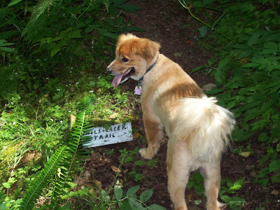
This sign was literally on the ground and evidently wasn’t what I thought it was. We ended up being on an entirely different trail. So it is definitely time for me to stop being ill prepared for hikes and invest in a good compass and perhaps some GPS equipment.

Sunday, July 27, 2008

Centennial Trail (Armar Trailhead)


Yesterday April, Bandit, Patches, Bogie and I got a late start for some trail action and the weather was quite cloudy. So we thought we would try to finish the Centennial trail off by starting at the most northern trailhead at the 17.75 mile marker and work our way down. As you can tell, the dogs were more than anxious for some trail action. Trail itself is like the rest of Centennial Trail, flat and well maintained. It is quite pretty and you can see some of the valley at different parts of the trail.

Just after you pass the 17 mile marker is the first water stop for the dogs and the only water we saw on this trip. I’m not sure how far we actually went because we never saw a trail marker after the 16 mile mark. My knee was fine but Bandit and Patches were really worn out and we turned around at the bridge that goes under 108th avenue. So I imagine we went probably went to the 15 mile marker down or perhaps close to the 14 mile marker. So I still haven’t traveled between the 12 mile marker and the 15 mile marker.


There is a number of nice picnic areas on this part of Centennial Trail. In fact, I think there is more individual picnic areas in this small part than the entire rest of the trail. The Armar trailhead is evidently very popular with the bicyclist and this is quite common for Centennial Trail on the whole.

Just before the 16 mile marker, you will see the Quilceda Watershed trailhead. Another very nice place for a quick picnic.

Here you can see the bridge in which we did the turn around.

Bandit and Patches were very tired dogs. They were sharing the same leash the entire time, so they did expend a lot of energy working against each other as they often wanted to go in different directions.

Bogie wasn’t that tired at all but he gets lot of trail action and the new puppy cut makes him much more streamlined.

Friday, July 25, 2008

Boulder River Falls Trail

It has been almost 2 weeks since I’ve done this trail. My left knee gave away on me on the way back and I’m still recovering. Hopefully, I’ll be able to get one more trail in before I make my journey to the Land Of Lincoln. Anyway, this trail takes a little time getting to and it is the most northern trail in my 60 Hikes Within 60 Miles Of Seattle book. The trailhead itself is quite a haul from the main road but still worth it.

Here you can see the trail head for the Boulder River trail.

We didn’t do the entire trail and that was good because a little while after turning back, that was when the left knee started acting like the Death Star after a well placed shot through the classic exhaust port. The trail itself changes from time to time and starts off a little dark due to a great canopy by the trees overhead.

Here you can see Bandit and Patches (Aprils dogs) and Bogie as they provide the lead for us non canine types.

It is only a mile or so to the falls and they are great. You can get right down underneath them to the rocky creek below and enjoy yourself.


Bogie taking a classic dip at the bottom of the falls.

Here April is posing for the camera and Patches thinks this means something is going on. I can only imagine that Patches is thinking ... “Not sure what you have in mind boss but I’m all in to support you.”

Bandit had decided that this is a good time to get close and personal with Mother Earth

All in all, I enjoyed the trail and plan on trying to do the entire thing sometime closer to the end of the summer.

Centennial Trail (Lake Stevens / Lake Cassidy Trailhead)


I’m way behind on posting this entry of our excursion on Centennial Trail starting at the Lake Stevens trailhead and going to one of the most northern spots on the trail. In fact, I’ve never gone as far north on this trail as I had on this little gaunt. We started at the Lake Stevens Trailhead (about mile marker 7.5) and went to trail marker 12 before turning back around.

Bogie profiling at the Lake Stevens trailhead.

Here is one of the maps of the trail that you can find (mostly on the northern trailheads)

Here we are just short of the Lake Cassidy trailhead. I had no idea the trail actually went up to the lake itself. I had brought water for Bogie and had just given a drink from his collapsable drinking dish. Felt a little silly when we made it to the lake.

Here we can see the information center at the Lake Cassidy trail head.

Bogie is going lake swimming.

The turn around at the 12 mile marker.


Heading back.

Monday, July 14, 2008

Centennial Trail (Machias Trailhead)

About 5 miles from the start of the Centennial Trail (in Snohomish) is the Machias trailhead. This is the most family friendly trailhead as it contains nice bathrooms, a play area, ample parking and a picnic area. This trailhead used to have an area where you could rent bicycles, roller blades and roller skates. That store also included snacks, trail gear and more. Unfortunately, that store has closed down for 2008 and hopefully it will come back in some form.

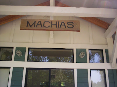
Here is the sign that hangs above the previous store.

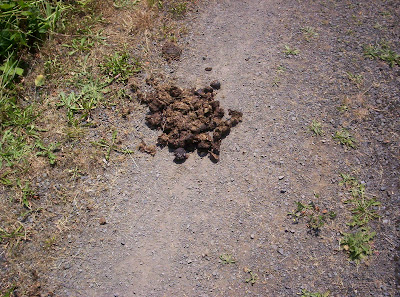
So this blog is about the trail between the Machias trailhead (mile marker 5) and the Lake Stevens trailhead (mile maker 7.5). One thing I would like to mention is that there is a horse trail that runs alongside the trail for most of the distance between the Pilchuck trail head and the Lake Stevens trail head. This is great if you want to walk your dog on the dirt trail instead of the asphalt. There are a few places where the horses do come on to the asphalt trail and you may have to dodge the evidence of that occasionally.

Evidence of a horse that was on the asphalt trail previously.

The trail itself is flat, in very good shape and hosts walkers, runners, bicyclists, rollerbladers and even the occasional skate boarder. Oh and occasionally, a dog will just lay down in the middle of the road as its owner snaps a picture.

Right about the 6 mile marker, the Little Pilchuck Creek crosses the trail. There are a few areas here where you can let your dog take a quick dip in the cool mountain runoff water.

The trail ends up in Lake Stevens and that trailhead has a huge amount of parking. If you come in the afternoon, you might want to park on the left side of the lot for the shade of the trees.

Friday, July 11, 2008

Book Review: On A Pale Horse

I just finished reading “On A Pale Horse” by Piers Anthony. April had recommended this and I was able to pickup the audio books on CD via a deal from eBay. This is the first novel of the INCARNATIONS OF IMMORTALITY series. I had read to his first six or so books on the Xanth series. I have to admit that I’m not that big of a fantasy guy as I am pure science fiction. This book was very original and I enjoyed it immensely. For some reason, I keep stumbling upon books or movies that deal with the personification of Death. I had recently rented Hogfather from Netflix. Both of these portrayed Death as “a regular joe just doing his job” that is thrust into some wild situations. Hogfather is great also, by the way, and I recommending adding it to your Netflix queue.

The primary character is named Zane and Death appeared to him as he was about to commit suicide. He changes his mind but cannot seem to be able to abort his intentions. At the last instant, he shoots Death in the face instead. This is from the inside cover of the book ...

When Zane shot Death, he learned, too late, that he would have to assume his place, speeding over the world riding his pale horse, and ending the lives of others. Sooner than he would have thought possible, Zane found himself being drawn to Satan's plot. Already the Prince of Evil was forging a trap in which Zane must act to destroy Luna, the woman he loved...unless he could discover the only way out....

The guy that reads the book is fantastic. Perhaps as good as Jim Dale, the guy that reads the Harry Potter books. His range is excellent and he does the separate character voices with precision. The story gives you different aspects of the other personified immortals such as Father Time, Mother Nature, Fate, War and Satan. God is mentioned but doesn’t make an appearance in this book.

Basically, it is very good story but the character development is the real draw to the book. You can also expect a healthy dose of explanations on how magic works in this reality. This isn’t nothing new to you if you have enjoyed any of the Xanth series of books but this approach is more adult. You find yourself thinking, “Well sure, that type of magic would have those limitations ... wait ... what they heck am I saying?”. If you get the chance, by all means check this book out. I’m treading through the second book now, which centers on Father Time (although he hasn’t made an appearance in the book yet).

Mount Pilchuck State Park Trail

I finished up business as quickly as I could and headed out of the office about 11:30 AM. It took about 40 minutes to reach the trailhead. The last time I tried this, I was turned back by the amount of snow on the road and that was about 3 weeks ago. Instead, I had done my first pass at the Heather Lake trail that is just about 5 miles before the Pilchuck starts. Only when we were at the parking area did I see snow and that was right next to the sign welcoming you to the park.

Here you can see Bogie wasting no time in enjoying the snow he sees.

The start of the trail isn’t marked that well but it was the only real opening we could see. With the snow melting, it looked more like a small waterway but we explored that direction. Almost immediately, we found the trail sign in station and more snow. So I had my doubts about how long I was going to spend on the trail. Hiking in snow isn’t my favorite form of hiking but later found the snow was heavy in spots and non existent in other spots. The hike if very pretty and we were both enjoying it quite a bit. There is only one stream that I came across and that was early and gushing pretty well. There was snow pack on both side and that made crossing the stream a little challenging but nothing to worry about.


Then the trail goes upward until you hit a bolder field. That was interesting and about the place were a family caught up with us. We let them pass because I was in no hurry and enjoying many stops to enjoy the view.


After that, we started hitting nothing but snow and the terrain was sloping quite a bit. My shoes were not handling it that well, the sky was beginning to cloud over quite a bit and I felt good about my explorations of the trail thus far (for an initial visit). So we headed back down the trail and decided to try it again in a couple weeks and see how the snow melt is coming along. That will be the end of July, so hopefully I wont have to compete for parking with too many families on stayvactions.

Here are some parking lot photos after our return.

Sammamish River Trail - Woodinville


April had the day off today but didn’t get over to my house until after 1 PM and that makes it a little bit challending to do any large trail. This is simply because people get off of work early and the parking lots for the trails can get a bit packed. We decided to do the Redmond Watershed trail but (for the first time), our 60 Trails Within 60 Miles of Seattle book let us down. The trailhead was not where the book states and the book didn’t state this was not a dog friendly trail. They allow horses but not dogs ... and ... that is not as uncommon as you would think. Literally, you can get a ticket for not picking up your dogs droppings as a horse drops enough to close down an entire lane of a trail. ..... anyway ...

The Sammamish River Trail is one of the trails that turns into the Burke Gillman trail and can be picked up at the Woodinville trailhead. In this series of pictures, we headed south towards Redmond. We didn’t get as far as Redmond because it was an uncommonly hot day in the Pacific Northwest (nearly 90 ... well not that near ... like 84).


Yes, we have to have our swim.

Here is a picture of one of the bug sculptures at the bug bridge. Turned around here for our short trail of the day.

Centennial Trail (Snohomish Trailhead)

So this is my second posting on Centennial Trail but this one is actually the start of the trail at the Snohomish trailhead. This section of the trail continues to the Pilchuck trailhead that is just under 2 miles away. This section of the trail goes by some very funky homes and is a great warmup for the rest of the trail.

Bogie at the start of the trail.

A little mall of stores that I haven’t ever made it into because the dog wonder always accompanies me on the trails.


Here you can see the Pilchuck trailhead that I've posted in the past.

Centennial Trail (Pilchuck Trailhead)